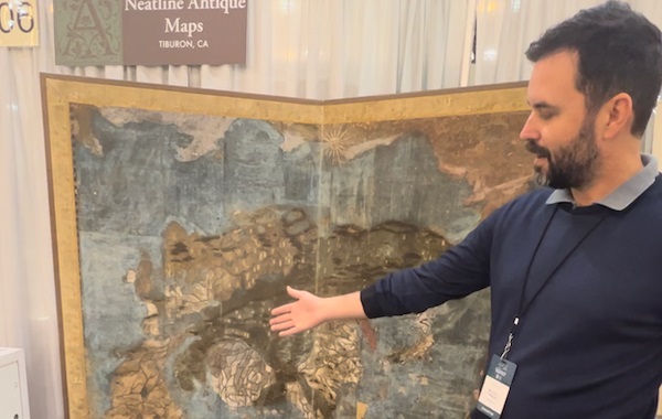
Maps are more than just tools for navigation; they are windows into history, art, and the imagination of ancient cultures. Authentic antique maps tell stories of exploration, discovery, and even conquest. But how did these intricate artifacts come to be? Let’s journey through time to uncover the fascinating history behind antique maps.
Early Cartography: The Birth of Maps
The Origins of Mapmaking
The earliest maps weren’t drawn to scale or precision; they were rudimentary sketches of land and sea. Ancient humans carved simple maps into rocks or drew them in the sand to represent their surroundings.
Maps in Ancient Civilizations
- Egyptian Cartography
Ancient Egyptians created maps primarily for resource management and construction projects. The Turin Papyrus Map (circa 1150 BCE) is one of the oldest surviving maps, depicting mining areas and roads. - Babylonian Maps
The Babylonian clay tablet known as the “Imago Mundi” (6th century BCE) showcases the known world as a circular area surrounded by water, emphasizing cosmological beliefs. - Greek Contributions
Greek scholars like Anaximander and Ptolemy introduced mathematical approaches to mapmaking, laying the groundwork for modern cartography.
The Role of Religion in Early Mapping
Religious beliefs deeply influenced early maps, often centering them around sacred locations. For instance, Jerusalem was depicted as the center of the world in medieval mappa mundi.
The Evolution of Antique Maps in the Middle Ages
The Influence of Medieval Europe
During the Middle Ages, European maps were less about accuracy and more about illustrating religious and mythological ideas.
Portolan Charts: Navigation’s Revolution
Portolan charts emerged in the 13th century, offering detailed coastlines and compass directions for sailors. These maps were vital for Mediterranean trade routes.
The Ptolemaic World Map
The rediscovery of Ptolemy’s “Geography” in the 15th century revolutionized European mapping by reintroducing latitude and longitude.
The Renaissance and Its Impact on Mapmaking
Rediscovery of Geography
The Renaissance was a golden age for mapmaking. Scholars revisited ancient texts, merging classical knowledge with contemporary discoveries.
Printing Press and the Mass Production of Maps
Johannes Gutenberg’s printing press allowed maps to be reproduced on a large scale, making them more accessible.
Famous Renaissance Cartographers
- Gerardus Mercator
Known for his cylindrical projection, Mercator’s maps are still used today for navigation. - Abraham Ortelius
Credited with creating the first modern atlas, Theatrum Orbis Terrarum (1570).
Maps in the Age of Exploration
How Maps Shaped the Age of Discovery
Maps became indispensable tools for explorers like Columbus and Magellan, charting new territories and sea routes.
The Role of Explorers in Cartography
Explorers often collaborated with cartographers, sharing their findings to refine maps of the New World.
Depictions of the New World
Antique maps from this era often depicted the Americas with exaggerated features, blending fact with fantasy.
The Artistry Behind Antique Maps
Craftsmanship and Materials Used
Early maps were painstakingly hand-drawn on parchment or vellum, making each piece unique.
Hand-Colored Maps
Maps were often enhanced with vibrant colors, highlighting regions, seas, and decorative elements.
Symbolism and Decorative Elements
Cartographers used elaborate borders, mythical creatures, and allegorical figures to elevate maps into works of art.
Maps as Tools of Power and Propaganda
Maps in Colonial Expansion
European empires used maps to assert claims over distant lands, often ignoring indigenous boundaries.
Political Borders and Territorial Claims
Maps were manipulated to justify territorial disputes and colonial ambitions.
The Use of Maps in Wars
During wars, maps became strategic assets, guiding troops and shaping military campaigns.
The Decline of Handcrafted Maps
Technological Advances in the 18th and 19th Centuries
The advent of lithography and advanced surveying techniques reduced the need for hand-drawn maps.
Rise of Modern Cartography
As science advanced, maps became more precise and less artistic.
Transition to Industrial Mapmaking
Mass production replaced the intricate, individualized craftsmanship of earlier maps.
Why Collectors Value Antique Maps Today
Rarity and Historical Significance
Antique maps offer insights into historical worldviews and geopolitical changes.
Artistic Appeal
Collectors prize their intricate designs and aesthetic beauty.
Investment Potential
With their rarity, antique maps often appreciate in value over time.
Preserving Antique Maps
Common Challenges in Preservation
Exposure to light, humidity, and handling can damage these delicate artifacts.
Techniques for Restoration
Professionals use careful cleaning and deacidification to restore maps.
The Role of Museums and Private Collectors
Museums and collectors play a crucial role in safeguarding these treasures for future generations.
Conclusion:
Antique maps are more than historical documents; they are cultural artifacts that reflect humanity’s enduring curiosity and creativity. Whether admired for their beauty or studied for their historical value, these maps remain timeless.
FAQs
- What defines an antique map?
An antique map is typically over 100 years old and reflects historical knowledge and artistic styles. - How were maps created before modern tools?
Early maps were hand-drawn on materials like parchment using rudimentary tools and observations. - Who were the most influential cartographers?
Gerardus Mercator, Abraham Ortelius, and Ptolemy are among the most celebrated. - Why are some antique maps so expensive?
Factors like rarity, age, condition, and historical significance drive their value. - How can I authenticate an antique map?
Look for period-appropriate materials, watermarks, and consult experts or dealers.
For More Details – https://neatlinemaps.com/


Leave a Reply